Best GPS Chartplotter for Lake Sakakawea
Navigating the immense and ever-changing waters of Lake Sakakawea can be a real challenge, even for seasoned anglers. With its sprawling bays, hidden submerged structures, and fluctuating water levels, finding those prime fishing spots and getting back to them reliably isn't just a convenience—it's absolutely critical for a successful day out. This guide is all about helping you cut through the confusion and choose the best GPS chartplotter to become your most trusted companion on North Dakota's vast "big lake."
Why a GPS Chartplotter is Essential for Lake Sakakawea Anglers
When you look at a body of water as vast as Lake Sakakawea, it can feel overwhelming. It’s not just a big lake; it’s a dynamic, ever-changing environment that can look completely different from one year to the next, or even one season to the next, especially with those fluctuating water levels. Relying solely on visual landmarks or a simple handheld GPS just isn't going to cut it when you're trying to consistently catch fish and stay safe. A dedicated GPS chartplotter goes far beyond basic navigation, providing a detailed, real-time map of the underwater world right at your fingertips.
The Challenges of Lake Sakakawea's Vastness
Imagine launching your boat at Parshall Bay or Van Hook Arm, looking out at miles of open water. Without a chartplotter, you're essentially driving blind when it comes to understanding the underwater topography. You might find a promising hump by chance, or accidentally drift over a submerged roadbed, but without marking it precisely, good luck finding it again. The sheer size of Lake Sakakawea means that popular fishing spots can be spread out over considerable distances, and traveling between them efficiently requires more than just a compass heading. It demands precision.
Furthermore, the weather on Lake Sakakawea can change in a heartbeat. A calm morning can quickly turn into a windy afternoon with significant chop, making it harder to spot subtle landmarks on shore. In these conditions, having a clear, accurate chart on your console showing your exact position relative to hazards and safe channels isn't just a nice-to-have; it's a vital safety tool. You'll thank your chartplotter when you're trying to navigate back to the boat ramp in deteriorating conditions, avoiding submerged rocks or shallow areas that could ruin your day, or worse.
Finding and Returning to Productive Fishing Spots
This is where a chartplotter truly shines for anglers. Fish, especially species like walleye, sauger, and even salmon, are creatures of structure. They relate to points, humps, drop-offs, submerged timber, and old creek channels. Lake Sakakawea is absolutely loaded with these features, but many of them are well below the surface, invisible to the naked eye. A quality chartplotter with detailed mapping allows you to see these contours, identify potential holding areas, and then, crucially, mark them with waypoints.
Let's say you're trolling a crankbait along a 20-foot breakline near the Missouri River Fishing Below Garrison Dam in North Dakota and suddenly hit a school of walleye. With a chartplotter, you can instantly drop a waypoint on that exact spot, giving you the ability to turn around and hit that precise section again and again. Or perhaps you're graphing baitfish congregated around a submerged island. Mark it, and you've found a potential hotspot for the day. Without this capability, you’re just hoping to stumble upon success, which isn't a great long-term strategy for consistent catches. The ability to record tracks, save waypoints, and even designate specific fishing zones is invaluable.
Key Features Every Lake Sakakawea Angler Needs in a Chartplotter
Choosing a chartplotter isn't just about buying the biggest screen. For the unique demands of Lake Sakakawea, certain features move from "nice-to-have" to "absolutely essential." Think about the conditions you'll face: big water, potentially rough rides, varying depths, and lots of subtle structures. Your chartplotter needs to be robust, intuitive, and packed with the right technology to give you an edge.
High-Resolution Display and Screen Size
On a large body of water like Lake Sakakawea, squinting at a small, low-resolution screen is both frustrating and inefficient. You need a display that's clear, bright, and large enough to easily discern contours, waypoints, and your boat's position, even in direct sunlight or when the boat is bouncing around. A screen size of at least 7 inches is generally recommended, with many serious anglers opting for 9 or 12 inches, or even larger, especially if it's the primary unit on the console.
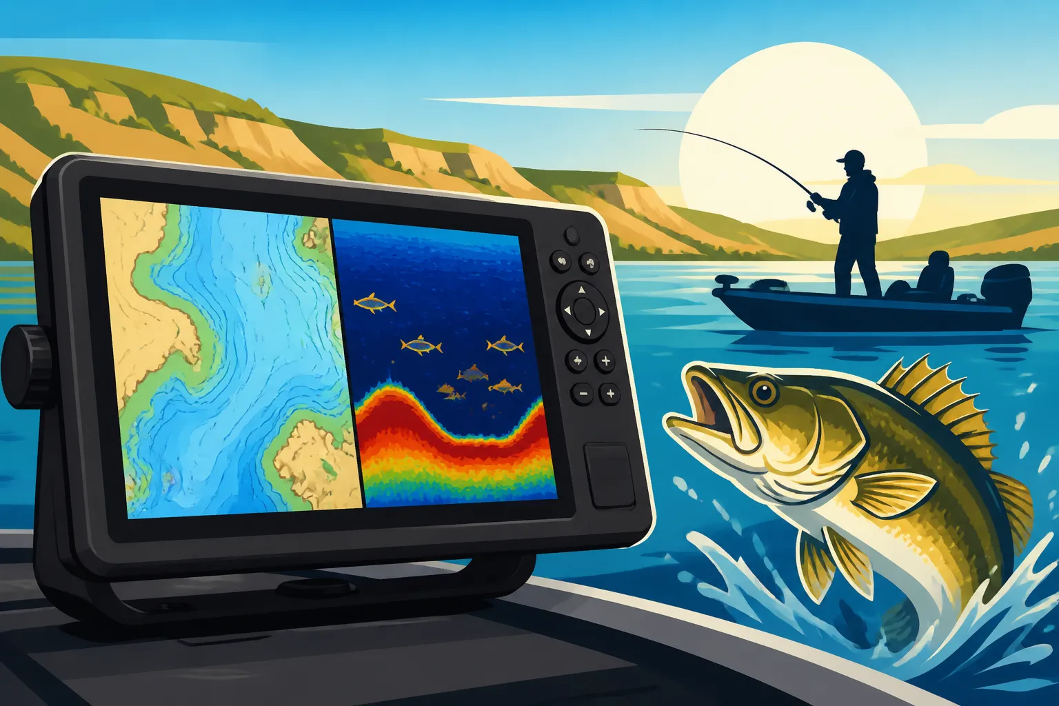
Resolution is just as important as physical size. A high-resolution display means sharper images, more detailed mapping, and clearer interpretations of your sonar returns. Imagine trying to distinguish between a subtle break and a flat bottom on a blurry screen – it's nearly impossible. Look for units that boast high pixel counts, which translate directly into better clarity. This clarity becomes even more important when you're splitting the screen to view both your chart and sonar simultaneously, a common practice for hunting walleye and other game fish relating to structure.
Detailed North Dakota Mapping Capabilities
This is arguably the most critical feature for Lake Sakakawea. Standard base maps, while functional for general navigation, often lack the granular detail needed for serious fishing. You need a chartplotter that can utilize advanced mapping chips or downloads specific to North Dakota, and ideally, Lake Sakakawea itself. These premium maps include ultra-detailed contour lines, often in 1-foot increments, which reveal those subtle humps, saddles, and creek channels that hold fish.
Look for mapping options that highlight depth changes, show navigational aids, and even indicate areas of submerged timber or rock piles. Brands like Humminbird with LakeMaster, Garmin with LakeVü g3 Ultra, and Lowrance with C-MAP offer these enhanced mapping solutions. Being able to visualize the underwater landscape in such detail allows you to formulate a precise fishing plan, target specific depths, and understand how fish might be relating to the structure. Without it, you're just guessing where the good spots might be. Don't cheap out on mapping; it's an investment that pays dividends in fish.
Integrated Sonar Technology
While a chartplotter handles the mapping, its true power for fishing comes when paired with robust sonar capabilities. For Lake Sakakawea, you'll want a unit that offers a combination of traditional 2D sonar, Down Imaging (or DownVu/DownScan), and Side Imaging (or SideVu/SideScan). Each technology provides a different, valuable perspective.
- Traditional 2D Sonar: This is your classic fish finder, showing arches (fish), baitfish schools, and bottom composition directly beneath the boat. It's excellent for seeing what's directly under you, especially when marking targets with specific settings.
- Down Imaging/DownVu/DownScan: This offers a picture-like view directly below your boat, making it much easier to distinguish between baitfish, game fish, and various types of underwater structure like trees or rock piles. It helps confirm what that 2D sonar "blob" really is.
- Side Imaging/SideVu/SideScan: This is a game-changer for covering vast areas efficiently. It scans out to the sides of your boat (sometimes up to hundreds of feet per side), allowing you to quickly find structure, brush piles, or schools of fish that you might otherwise miss by driving directly over them. On Lake Sakakawea's sprawling flats or along extensive breaklines, Side Imaging lets you find those isolated humps or rock reefs much faster.
Consider units that also offer high-frequency CHIRP sonar, which provides even greater target separation and clarity at various depths. The combination of these technologies will give you a comprehensive understanding of the water column and bottom structure, essential for locating fish on such a diverse lake. Best Fish Finders for North Dakota Lakes goes into more detail on how these technologies work.
Popular Chartplotter Brands and What They Offer for North Dakota Waters
When it comes to marine electronics, a few big names consistently rise to the top, offering robust and feature-rich chartplotters that are well-suited for the demanding environment of Lake Sakakawea. Each brand has its loyal followers and unique strengths, so understanding what each brings to the table can help you make an informed decision. You might find a great selection of these units at major retailers, perhaps even browsing options on Amazon or checking out the displays at your local Bass Pro Shops.
Garmin: User-Friendly and Feature-Rich
Garmin is a household name in GPS technology, and their marine division carries that reputation into chartplotters. They are widely praised for their intuitive user interfaces, making them relatively easy for new users to pick up and operate. Their ECHOMAP and GPSMAP series are particularly popular among freshwater anglers.
- Key Features for Sakakawea: Garmin units often come preloaded with their LakeVü g3 or LakeVü g3 Ultra mapping, which provides exceptional detail for North Dakota lakes, including Lake Sakakawea. These maps boast 1-foot contours for many bodies of water and access to Navionics data. Their Quickdraw Contours feature also allows you to create your own custom HD maps in real-time as you motor along, which is fantastic for discovering uncharted spots or updating existing maps for changing water levels.
- Sonar Strengths: Garmin's Ultra High-Definition ClearVü and SideVü offer incredibly clear, photo-like sonar images of what's below and to the sides of your boat. They also have Panoptix LiveScope technology, which provides real-time, live-scanning sonar images of fish and structure up to 100 feet away in any direction around your boat – a truly revolutionary tool for sight fishing or pinpointing structure.
- Integration: Garmin chartplotters integrate seamlessly with their Force trolling motors, allowing for precise boat control, anchor mode, and waypoint navigation directly from the chartplotter screen.
Many North Dakota anglers appreciate Garmin's ease of use, especially when trying to quickly mark a hotspot or navigate back through a complex series of turns.
Humminbird: Imaging King and LakeMaster Depth
Humminbird has long been a favorite, especially among serious walleye and bass anglers, largely due to their groundbreaking Side Imaging technology and superior mapping. Their HELIX and SOLIX series are workhorses on big lakes.
- Key Features for Sakakawea: Humminbird's crown jewel is its LakeMaster mapping. The LakeMaster Plus chips are renowned for their highly accurate, detailed contour lines (often 1-foot), depth highlighting, and even the ability to offset contours to match current water levels—an invaluable feature on a fluctuating lake like Sakakawea. This allows you to always fish the "right" depth, regardless of how much the lake level has changed. Their Basemap included with units is also quite good, but the LakeMaster chips take it to another level.
- Sonar Strengths: Humminbird essentially pioneered Side Imaging, and their MEGA Side Imaging+ and MEGA Down Imaging+ offer incredible clarity and range, allowing you to scan vast areas quickly and pick out subtle structures or fish relating to them. The detail is often so fine you can identify specific species of submerged trees or individual rocks.
- Integration: Humminbird chartplotters integrate tightly with their Minn Kota trolling motors via the One-Boat Network. This allows you to control your trolling motor, follow contours, and drop waypoints directly from your Humminbird screen, creating a highly efficient fishing system.
Anglers focused on finding specific underwater structures and patterns will often gravitate towards Humminbird for its imaging prowess and LakeMaster mapping.
Lowrance: Power and Connectivity
Lowrance has a long history in marine electronics, known for powerful sonar and network capabilities. Their HDS and Elite FS series are popular choices, offering advanced features for serious fishermen.
- Key Features for Sakakawea: Lowrance units come with C-MAP Contour+ charts preloaded, offering detailed 1-foot contours on many lakes, including Lake Sakakawea. They also support C-MAP Reveal charts, which provide an even more realistic, shaded relief view of underwater topography, making it easier to visualize structure. Like Garmin, they have Genesis Live, which lets you map uncharted areas in real-time.
- Sonar Strengths: Lowrance's Active Imaging 3-in-1 sonar (CHIRP, SideScan, and DownScan) provides excellent clarity and detail. Their ActiveTarget Live Sonar offers real-time views of fish movement and structure similar to Garmin's LiveScope, allowing you to watch fish react to your bait.
- Integration: Lowrance chartplotters integrate well with MotorGuide trolling motors and other networked accessories, allowing you to build a comprehensive fishing system. Their robust networking capabilities are a major draw for those who want multiple displays and interconnected devices on their boat.
Lowrance appeals to anglers who want powerful sonar, detailed mapping options, and strong networking capabilities to connect all their boat's electronics.
Getting the Most Out of Your Chartplotter on Lake Sakakawea
Simply having a top-of-the-line chartplotter isn't enough; you need to know how to use it effectively to unlock its full potential on a challenging lake like Sakakawea. This involves understanding your settings, utilizing its mapping capabilities, and practicing with it regularly.
Customizing Settings for Optimal Performance
Out of the box, your chartplotter will likely have decent default settings, but to truly optimize its performance for Lake Sakakawea's unique characteristics, you'll need to do some tweaking. This includes adjusting sonar sensitivity, frequency, range, and color palettes.
For instance, in deeper sections of Lake Sakakawea, you might need to lower your sonar frequency for better depth penetration, or increase sensitivity to pick up faint returns from baitfish or smaller fish. In shallower, weedier areas, a higher frequency might give you better target separation. Playing with the color palette on your sonar can also make a huge difference in how clearly you can distinguish between bottom hardness, fish, and bait. A good rule of thumb is to start with defaults, then incrementally adjust one setting at a time to see its effect. Don't be afraid to experiment, and consult your unit's manual or online forums for recommended settings for your specific model and fishing conditions. Taking the time to fine-tune these settings will significantly improve your ability to find fish and interpret the underwater world.
Leveraging Advanced Mapping Features
Your chartplotter’s mapping isn’t just a pretty picture; it’s a strategic tool. Learn to use all its advanced features. This includes:
- Depth Shading/Highlighting: Most premium mapping offers the ability to color-code specific depth ranges. On Sakakawea, this is incredibly useful for targeting walleye that might be holding in a specific depth range, say 15-20 feet, or for quickly identifying shallow hazards.
- Custom Contours (e.g., Garmin Quickdraw, Lowrance Genesis Live, Humminbird AutoChart Live): These features allow you to create your own high-definition maps in real-time. This is invaluable on Lake Sakakawea, especially in areas where official maps might be less detailed or outdated due to changing water levels. By mapping areas yourself, you can discover new, previously unmapped structures that could hold fish.
- Waypoint Management: Develop a system for organizing your waypoints. Label them clearly (e.g., "Walleye Hump," "Rock Pile," "Crappie Brush," "Home Ramp") and use different icons for different types of spots. Regularly review and declutter your waypoints, keeping only the most productive ones. A messy waypoint list can be just as confusing as no waypoints at all. Use your chartplotter to also track your boat's path (breadcrumbing) to retrace successful trolling passes or explore new areas methodically.
Remember to regularly update your mapping chips or software. Manufacturers frequently release updates with improved map data, new features, and bug fixes. Staying current ensures you have the most accurate information at your disposal.
Practical Tips for Big Water Navigation and Safety
Lake Sakakawea demands respect, and your chartplotter plays a crucial role in safe navigation, especially when the weather turns.
- Always Carry a Backup: While highly reliable, electronics can fail. It’s always a good idea to have a paper map of the lake and a compass, or at least a fully charged smartphone with a mapping app, as a backup. North Dakota Fishing Regulations Explained emphasizes safety.
- Monitor Weather and Water Levels: Stay informed about changing weather forecasts. Your chartplotter isn't a weather station, but knowing what's coming can help you make decisions based on your current position relative to safety. Keep an eye on the lake's water levels, as they directly impact charted depths and can expose new hazards or submerge known ones.
- Practice, Practice, Practice: The best way to get comfortable with your chartplotter is to use it. Spend time on the water not just fishing, but actively navigating, marking waypoints, and exploring different sonar views. Learn how to quickly zoom, pan, and switch between screens. The more familiar you are with your unit, the more effective you'll be when it counts. Consider buying a few accessories from a store like Bass Pro Shops or online at Amazon to enhance your experience, such as a screen protector or a sun cover. North Dakota Boat Registration Requirements also covers safety equipment you'll need.
By combining powerful features with smart usage, your GPS chartplotter will transform your experience on Lake Sakakawea, turning what can be a daunting expanse into a readable, conquerable fishing ground.
| Feature Type | Essential for Sakakawea (Yes/No) | Why It Matters | Typical Cost Impact (Relative) |
|---|---|---|---|
| Large Screen Size | Yes | Easier viewing, split-screen for chart and sonar. | Medium |
| High-Res Display | Yes | Clearer images, better detail for maps and sonar. | Medium |
| Detailed ND Mapping | Yes | 1-foot contours, depth highlighting, accurate structure for fishing. | High (often premium add-on) |
| 2D CHIRP Sonar | Yes | Excellent target separation, clear fish arches and bottom detail. | Medium |
| Down Imaging | Yes | Photo-like views of what's directly below, identifies structure. | Medium |
| Side Imaging | Yes | Scans wide areas quickly, finds off-set structure and fish schools efficiently. | High |
| Real-time Mapping | Highly Recommended | Create/update maps for fluctuating water levels, discover new spots. | Medium |
| Network Capability | Recommended | Connects to trolling motors, other displays for integrated system. | Medium |
| Touchscreen | Preference | Intuitive control, but buttons might be better in rough water. | Low (standard on many) |
| Live Sonar | Advanced, but not essential | Real-time views of fish and bait, very effective but higher cost. | Very High |
Disclaimer
This article is for general informational purposes only and does not constitute professional advice. Laws, prices and regulations vary by location and change over time. Consult a qualified professional for guidance on your specific situation.